
Water/Wastewater
Published over 12 years ago. See the latest and most current information on Water/Wastewater.
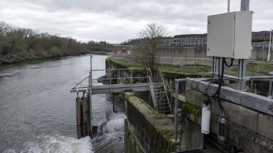
Mott MacDonald’s (UK) innovative approach to flood modelling has enabled the Environment Agency of England and Wales to improve the accuracy of warnings during recent tidal surge events. Flood scenario risk maps and improved real-time forecasting and warning tools were recently used for emergency planning and evacuation exercises along 220km of the east coast between South Ferriby on the Humber Estuary and Hunstanton on the Wash.
Tidal defences have been raised and strengthened over the years to reduce the risk of flooding, while there have been great improvements in the forecasting of atmospheric and tidal conditions. Nevertheless, the New Year floods have demonstrated that surges, high tides and strong winds still pose a real threat to loss of life and property. Successfully translating offshore forecasts into meaningful information for flood warning and emergency response purposes remains a challenge.
Sun Yan Evans, technical director with Mott MacDonald, said: “Last December’s storm surge was the largest recorded since the 1953 coastal flood events. The impact on homes and infrastructure would have been far greater, were it not for decades of investment by the Environment Agency and its predecessors to improve flood defences. With more tidal surges predicted, these defences will really be put to the test in the future.”
Mott MacDonald’s methodology, developed with the Environment Agency, creates scientific computer models to enable effective planning for responding to tidal flooding and long-term land use planning policies, including climate change, sea level rise and land sinking. A range of practical tools developed by the consultancy provides the Environment Agency with real-time forecasting of tidal overtopping and prioritisation of potential breach locations.
“Knowing more about the defences and being able to carry out better threat assessments in advance of high tides has dramatically improved our ability to anticipate where overtopping or breaches will occur. As Met Office weather and sea level forecasts are fed into the model in real-time we know where the effects of tides, wind and waves will be most severe. Algorithms then combine this data with the information on coastal defences to calculate the probability and severity of flooding,” Sun Yan added.


.jpg)