Consultancy services
Published over 15 years ago. See the latest and most current information on Consultancy services.
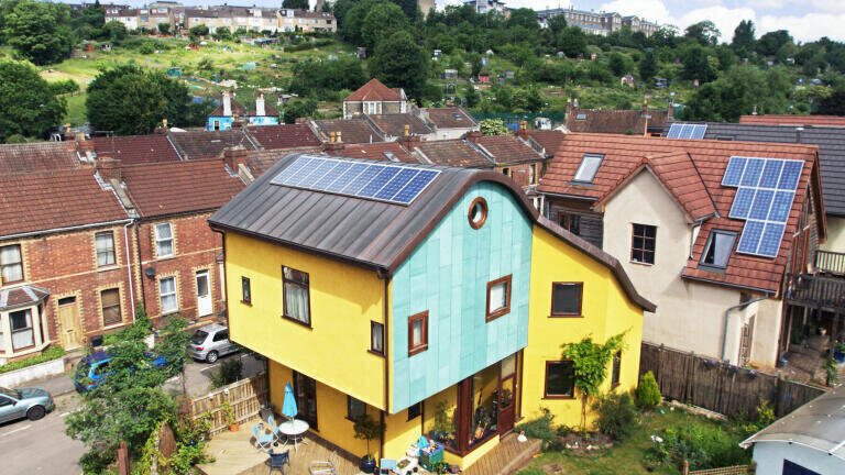
Bluesky (UK) is developing ground-breaking technology to automatically pinpoint the best locations for solar panels. Using aerial remote sensing technology including aircraft mounted lasers and digital aerial photography, the 3D solar energy maps will identify homes and other buildings with roofs that may be suitable for mounting solar panels to generate renewable energy.
Bluesky already has access to the raw aerial data for the whole of the UK and measurements such as the shape, pitch, size and aspect of building roofs are being extracted - information that is essential when considering the potential for solar energy installations.
“Using data that has already been used to create 3D maps and assess environmental risks such as flooding, we are creating citywide maps of solar energy potential. We believe this is the first time this has been done in the UK and we are following in the footsteps of cities like New York, San Francisco and Boston,” commented Rachel Tidmarsh, Managing Director of Bluesky. “Despite the popular perception of UK weather there exists an enormous potential for solar energy and the solar maps we are creating can be used by home owners to make an initial assessment about the suitability of their property or by Local Authorities or Utility companies to understand the wider potential.”
Energy from the sun is called solar energy and provides light, heat and energy to all living things on earth. This energy can be harnessed by thermal solar panels or hot water heating solar panels to provide useable energy to power UK homes and businesses. It is estimated that the UK receives 60 per cent of the solar energy compared with locations at the equator. This is equivalent to 1000 power stations. On average each square metre of the UK receives between 900 – 1200kwh each year.
Bluesky already has access to comprehensive range of off the shelf data that can be used to extract information from which to create solar maps including nationwide coverage of Digital Terrain and Digital Surface Models (DTM / DSM), the most comprehensive LiDAR (Light Detection and Ranging) coverage of the UK and highly accurate and detailed 3D building models for all major UK cities. This information can be enhanced with high-resolution aerial photography available from the GeoPerspectives product range, mapping or thermal imagery for property heat loss analysis.


.jpg)